


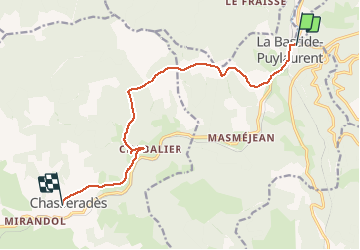
La bastide saint Laurent chasserades

ARVIEU
User

Length
11.5 km

Max alt
1313 m

Uphill gradient
402 m
Km-Effort
16.4 km

Min alt
1020 m

Downhill gradient
252 m
Boucle
No
Creation date :
2019-12-13 07:11:35.838
Updated on :
2019-12-13 07:12:24.218
4h00
Difficulty : Medium

FREE GPS app for hiking
 SityTrail
IGN / Geographical institutes
SityTrail Plus
The world is yours!
About
Trail On foot of 11.5 km to be discovered at Occitania, Lozère, La Bastide-Puylaurent. This trail is proposed by ARVIEU.
Positioning
Country:
France
Region :
Occitania
Department/Province :
Lozère
Municipality :
La Bastide-Puylaurent
Location:
Unknown
Start:(Dec)
Start:(UTM)
571857 ; 4937897 (31T) N.
Comments